

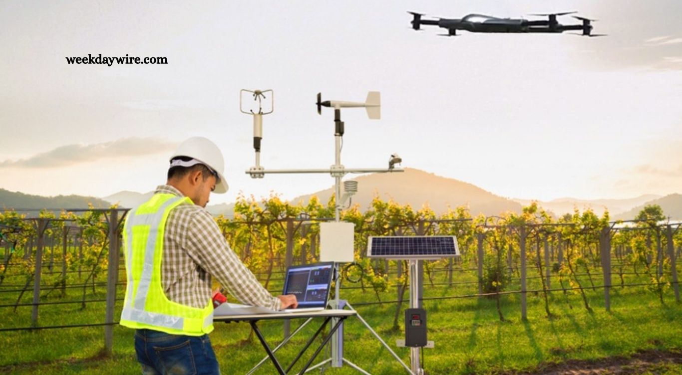
Extreme weather events are becoming increasingly challenging to monitor and predict. Severe thunderstorms, tornadoes, hurricanes, floods, and other dangerous conditions can develop quickly, leaving communities with limited time to prepare. Accurate weather data collected at the right moment can make a major difference in improving forecasts and delivering timely warnings.
A groundbreaking research effort involving the National Oceanic and Atmospheric Administration (NOAA) and the University of Oklahoma is exploring how drones could provide valuable real-time information during changing weather conditions. Researchers are examining whether data gathered by unmanned aircraft can strengthen forecasting systems and help officials better understand severe weather as it develops.
Drones Bring Weather Data Closer to the Action
Traditional weather monitoring relies on satellites, radar systems, weather stations, weather balloons, and aircraft. These technologies provide essential information, but each has limitations. Some observations may not capture conditions close to the ground or within rapidly developing storms with enough detail.
Read More: What Residents Should Know About Recent Community Updates
Drones could help fill some of these gaps. Small unmanned aircraft can be deployed into specific areas to measure atmospheric conditions and gather information from locations that are difficult or dangerous for people to access.
Researchers can use drones to collect measurements such as temperature, humidity, pressure, wind conditions, and other atmospheric information. When these observations are gathered in real time, scientists can gain a clearer picture of how weather conditions are changing.
Improving Severe Weather Forecasts
Weather forecasting depends heavily on accurate observations. Forecasting models process enormous amounts of atmospheric data to estimate what could happen next. Even small improvements in the quality, location, and timing of observations can potentially improve those predictions.
Drone-based measurements could provide additional information in areas where existing observing systems have limited coverage. Researchers are studying whether these observations can be incorporated into forecasting models and whether they can help meteorologists identify changing conditions earlier.
The potential benefit is particularly important for severe weather. Tornadoes and powerful thunderstorms can develop rapidly, making every additional minute valuable for emergency officials and the public.
Real-Time Information Could Strengthen Weather Warnings
One of the most promising aspects of drone technology is its ability to collect information quickly and from targeted locations. Instead of relying only on observations from fixed stations, researchers could deploy drones where additional atmospheric information is needed.
Real-time observations could help meteorologists monitor changes in the atmosphere as storms form or intensify. Better information could support more precise warnings and improve understanding of storm behavior.
For communities facing severe weather, more accurate warnings could provide additional time to seek shelter, protect property, close roads, or activate emergency response plans.
Drones Offer a Safer Way to Gather Data
Severe weather research can involve significant risks. Sending people or crewed aircraft into dangerous conditions can be expensive and potentially hazardous. Drones provide another option for collecting observations while keeping personnel farther away from dangerous environments.
Unmanned aircraft can operate in locations where conditions may be unsuitable for conventional field measurements. Their relatively small size and flexibility also make them useful for targeted research missions.
However, drones are not expected to replace established weather technologies. Instead, researchers are investigating how unmanned systems could complement radar, satellites, weather stations, balloons, and aircraft.
NOAA and University Researchers Explore New Possibilities
The collaboration between NOAA and researchers at the University of Oklahoma reflects a broader effort to improve the way atmospheric data is collected. Oklahoma is particularly relevant for severe-weather research because the region experiences frequent thunderstorms and tornadoes.
Researchers can test drone technology under challenging atmospheric conditions and evaluate how useful the resulting observations are for weather science. The collected information can also help scientists understand the atmosphere at smaller scales that may be difficult to capture through conventional observing systems.
The research is part of a larger movement toward combining advanced technology with established forecasting methods. As computing power, sensors, communication systems, and autonomous aircraft improve, drones could become increasingly valuable tools for atmospheric research.
Challenges Still Need to Be Solved
Despite their potential, drone-based weather observation comes with technical and operational challenges. Drones must operate safely, communicate reliably, and carry sensors capable of producing accurate measurements.
Weather itself can also create difficulties. Strong winds, heavy precipitation, lightning, and rapidly changing conditions can affect drone performance. Researchers must determine how unmanned aircraft can safely operate in such environments while maintaining reliable data collection.
Regulatory requirements and airspace restrictions also need to be considered. Large-scale use of drones for weather monitoring would require careful coordination with aviation authorities and other aircraft operating in the same region.
The Future of Drone-Based Weather Monitoring
The growing use of drones could eventually create a more detailed network of atmospheric observations. Instead of depending exclusively on large observation systems, meteorologists could have access to smaller, flexible platforms capable of gathering data exactly where it is needed.
Future developments could include more advanced sensors, longer flight times, improved autonomous navigation, and faster communication between drones and forecasting systems. Artificial intelligence and machine learning could also help researchers analyze the large volumes of information collected by unmanned aircraft.
The ultimate goal is not simply to collect more data. It is to collect better data at the right place and the right time so meteorologists can make more informed decisions.
A Promising Step Toward Better Weather Preparedness
Extreme weather will continue to challenge communities around the world, creating a constant need for faster and more accurate forecasting. Research involving NOAA, the University of Oklahoma, and drone technology demonstrates how emerging tools could strengthen traditional weather observation methods.
If researchers can successfully integrate real-time drone observations into forecasting systems, the technology could contribute to earlier and more accurate warnings. While significant testing and development remain, drones represent a promising addition to the future of severe-weather research and emergency preparedness.
Frequently Asked Questions
How can drones help monitor extreme weather?
Drones can collect real-time atmospheric data, including temperature, humidity, pressure, and wind conditions, from targeted locations.
Can drones improve weather forecasts?
Yes. Drone observations may provide additional data that helps meteorologists improve forecasting models and understand changing weather conditions.
How can drones improve severe weather warnings?
Real-time drone data can help meteorologists monitor rapidly changing atmospheric conditions and potentially issue more accurate warnings.
Are drones safe to use during extreme weather?
Drones can reduce risks to researchers by collecting information remotely, although strong winds, lightning, and heavy rain can affect operations.
What weather information can drones collect?
Depending on their sensors, drones can measure temperature, humidity, atmospheric pressure, wind speed, and other environmental conditions.
Can drones replace weather satellites and radar?
No. Drones are expected to complement existing systems by providing detailed observations from locations where conventional tools have limited coverage.
What is the future of drones in weather research?
Future drones could feature better sensors, longer flight times, autonomous navigation, and improved integration with advanced weather forecasting systems.
Conclusion
Drone technology is opening new possibilities for extreme weather research by providing detailed, real-time atmospheric data from challenging locations. Research involving NOAA and the University of Oklahoma could help scientists understand rapidly changing weather conditions and improve forecasting accuracy.
